Fire prevention and floods, presentation of “Albania 1” and “Albania 2” their monitoring results
-
Published: Wednesday, 05 July 2023 15:07
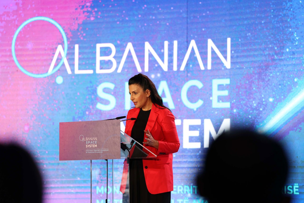
The first results of satellite service were presented today, in an event attended by Prime Minister Edi Rama, Defense Minister Niko Peleshi, heads of various institutions and experts.
Deputy Prime Minister Belinda Balluku said that Albania has managed to monitor 47% of the territory through two satellites "Albania 1" and "Albania 2", launched into space.
With a wide range of usage, from fire prevention to floods prevention, including agriculture and illegal construction, Albania, through "Albania 1" and "Albania 2" satellites launched into space, according to Deputy Prime Minister Belinda Balluku: "Becomes part of the new space economy, enhancing its involvement in the space community, while using the power of high-resolution satellite images, which enable the realization of our ambitions as a NATO member country".
Prime Minister Edi Rama said that thanks to the satellite service we have a fantastic basis for evaluating the territory according to the needs of the departments, which makes corruption impossible in many areas: "Until June 21, data has been collected from 16,324 km2 of the Republic of Albania. Because the weather made the work of those involved in this process very difficult, the service provider company added 8 more satellites at no extra charge to provide us with more images in those periods of time," said the prime minister.
Speaking about the floods, Prime Minister Edi Rama said that: "The satellite map makes it impossible for a flood of 3 km2 to turn into a flood of 15 km2 by adding victims of water and damaged property, with the aim of increasing the bill at the expense of the state, increasing the rate of corruption. This is because it is the images that identify the damage, which until yesterday was done by people on the ground". Prime Minister Edi Rama invited IT employees to work for the Albanian state, promising better and more competitive salaries than in the private sector, even compared to the region.
During the activity, two examples were presented where the Civil Protection Agency has obtained valuable information through satellites, such as the case of the fire on the island of Sazan, in June 2022, while the second case is related to the floods in in the village of Muriqan, the district of Shkodra. According to the representative of the Civil Protection Agency, Gentiana Maçi, this monitoring helps prevention and an as efficiently as possible intervention.
A team of experts from all institutions have since long started training at Satellogic on how to use of advanced technology for processing and analyzing satellite images. ASIG's trained team is building cases and examples that will help public institutions to analyze and make decisions in the shortest time possible.
Articles from Newsroom
Defence Minister Ermal Nufi inspects progress of Guna Tactical investment
Wednesday, 15 July 2026
Defence Minister Nufi receives Chief of the German Armed Forces, General Carsten Breuer
Wednesday, 15 July 2026